
Identify and recognize tablet in your image. Our image recognition tool uses machine learning and will also identify other objects found in your image. You can also select and vary the detection confidence and the number of objects that you want to detect.
Use AI to identify objects in your image. Vary the detection confidence and the number of objects that you want to detect below.

Click image to enlarge
The word and object ‘tablet’ has a frequency score of 3.45 out of 7, which means that it is not a very popular word, but is used quite frequently in English.
According to the English dictionary, some meanings of ‘tablet’ include:
- a dose of medicine in the form of a small pellet (noun)
- a number of sheets of paper fastened together along one edge (noun)
- a slab of stone or wood suitable for bearing an inscription (noun)
- a small flat compressed cake of some substance (noun)
Image Recognition in Smart Cities
What smart cities need and why images matter
Smart cities are built to make everyday life safer, cleaner, and easier by using data to improve public services. That data can come from many places, but images and video are some of the richest sources because they capture what is happening in real time. Cameras on streets, in public buildings, and on public transport already exist in most cities, and image recognition helps turn those visuals into useful information. Instead of relying only on people to watch screens or read reports, software can detect patterns and events automatically. This can include counting traffic, spotting hazards, measuring how crowded a place is, or identifying when something needs attention. The goal is not “more cameras,” but smarter use of visual data so cities can respond faster and plan better.
Traffic flow, road safety, and public transport
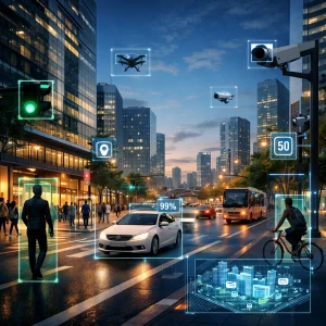
One of the most common smart city uses of image recognition is transportation. Computer vision systems can detect vehicles, bicycles, and pedestrians, then estimate speed, congestion, and near misses at intersections. This helps city teams adjust traffic light timing, improve crossing signals, and understand where road design causes frequent problems. Image recognition can also support incident detection, such as identifying stopped vehicles, wrong-way driving, or debris on the road, so responders can act quickly. On public transport, cameras combined with image recognition can estimate crowding levels on platforms and inside stations, helping operators reduce bottlenecks and improve service planning. In parking areas, visual recognition can guide drivers to available spaces or support automated enforcement of rules in a more consistent way. When used carefully, these tools reduce delays and improve safety without requiring major changes to infrastructure.
Cleaner streets and better city maintenance
Smart cities also need efficient maintenance, because small issues can turn into expensive problems when ignored. Image recognition can help by detecting potholes, cracks, faded lane markings, broken streetlights, or damaged signs. Cities can mount cameras on buses or service vehicles and collect images during normal routes, then use software to flag areas that need repair. This approach can be faster and cheaper than manual inspections, and it can create a clear record of changes over time. Waste management can benefit too. Vision systems can identify overflowing bins, illegal dumping, or blocked alleys that stop collection trucks from working efficiently. In public spaces, image recognition can support park and facility management by tracking usage patterns, so cities understand which areas need more cleaning, more lighting, or better accessibility features. Over time, this turns maintenance into a planned process based on evidence rather than complaints alone.
Environmental monitoring and emergency response
Image recognition can also help cities protect the environment and respond to emergencies. For air and water quality projects, vision-based tools can monitor smoke, dust, or visible pollution events and combine that information with sensor readings to locate likely sources. In coastal or river cities, cameras can assist with flood monitoring by measuring water levels at known points, detecting debris buildup near bridges, or spotting early overflow risks during storms. During wildfires, computer vision can help detect smoke plumes sooner, supporting faster alerts. In emergencies like fires or major accidents, image recognition can support situational awareness by scanning camera feeds for hazards, identifying blocked roads, and estimating crowd movement so teams can guide people to safer routes. These systems are especially valuable when minutes matter, but they work best when paired with clear procedures and trained staff who can validate and act on the results.
Privacy, fairness, and responsible deployment
Because smart city projects often involve public spaces, responsible use is essential. Image recognition should be designed with privacy in mind, including limiting what data is collected, how long it is stored, and who can access it. Many smart city goals can be reached without identifying individuals at all, using techniques such as counting objects, detecting motion, or anonymizing faces and license plates. When identity-based tools like facial recognition are considered, cities should set strict rules, require strong legal oversight, and communicate clearly with the public about what is being used and why. Accuracy and fairness matter too, since poor performance can lead to incorrect decisions or unequal impact on different communities. A good approach includes regular audits, testing across varied conditions, human review for high-stakes actions, and transparent reporting. When image recognition is deployed with clear limits and strong governance, it can support safer streets, smoother travel, and better city services while respecting the rights of the people who live there.
Learn more
- Image Recognition Overview
- What is Machine Learning?
- Top 5 Uses of Image Recognition
- Are Machines becoming Smarter than Humans?
- Rising Popularity of Image Recognition
- Image Recognition Trends
- Prevent Crime and Improve Security with Facial Recognition
- Image Recognition in Medical Use
- Image Recognition Software on Cloud Platforms
- Image Recognition is Transforming Business
- Facial Recognition for Brand Awareness
- Image Recognition on Facebook
- Future of Image Recognition
- How Image Recognition is Changing Online Shopping
- How Image Recognition is Improving Online Security
- Image Recognition for Environmental Protection
- How Image Recognition is Enhancing Customer Experience
- How Image Recognition is Enhancing Education
- How Image Recognition Supports Transportation Systems
- How Image Recognition is Streamlining Manufacturing Processes
- How Image Recognition is Helping Agriculture Thrive
- Understanding How Image Recognition Improves Accessibility
- How Image Recognition is Simplifying Everyday Life
- How to Choose Image Recognition Software
- How Image Recognition Helps Content Moderation
- How Image Recognition Works Step by Step
- Image Recognition in Smart Cities
- Image Recognition and Data Privacy
- Benefits of OCR for Modern Businesses